Showing posts with label Summerhill. Show all posts

Tuesday, March 16, 2021

History: Summerhill attacked during the Irish Confederation Wars- The Historic Battle of Dungan's Hill


We have to wonder if our ancestors were at Umberstown and Dangan in the 1600's. We know they were certainly there by the 1700's, so it is very likely. If so, they witnessed, and perhaps took part in, a bloody battle of epic proportions and its terrible aftermath.

In the 1600's there was a fine house and old castle in Knock (now Summerhill,)  a fine stone house in Dangan with a bridge and mill, and a few cabins in Umberstown and other townlands. There were  small castles in the surrounding townlands of Readstown, Little Freffans, Adamstown, and Laracor.


If you visit Summerhill, you will see this ancient stone pedestal on the village green It is the cross of Peter Lynch of Knock, who had been associated with the Irish Catholic rebellion of "Silken Thomas" (a Kinsella) in 1535. By 1609 there was a new castle on the land and the 1640 survey showed Garrett Lynch of Knock owning 590 acres, with two castles, a mill, an old chapel, and many cottages.

                                      Ruins of Lynch's castle in Summerhill


But in 1642, while Gerald/Garrett was away, the castle at Lynche's Knock was attacked by the forces of the Protestant Irish Royal Army under James Butler, Earl of Ormonde.  All of the male defenders of the castle were executed. This was one bloody scene only 3 miles from our ancestors' cottages at Dangan. But a far worse battle was yet to come.

James Butler, Earl of Ormonde


The Irish Confederation Wars (Eleven Years' War) 1641-1653

From 1642-1649, the Irish Catholic Confederation, based in Kilkenny, ruled 2/3 of Ireland. It had been formed by Catholic nobles, clergy, and military leaders after the Irish Rebellion of 1641, which sought to regain Irish Catholic rights. It held allegiance to the Catholic king of England-King Charles I. 

The Irish Confederation Wars (Eleven Years War) lasted from 1641-1653. The Irish Catholic Confederation allied with English and Scottish Royalists against the English Parliamentarians. Small bands of civilians were raised by local lords to attack the opposing side.

During this horrific war over 25,000 Irish were killed on the battlefield, and over 200,000 civilians died from famine and disease, with 12,000 being transported to the West Indies by 1660. 

In 1645 King Charles I was defeated during the English Civil War, with Parliamentarians taking power. In June 1647, James Butler, The Marquis of Ormond, who had been loyal to Charles, agreed to surrender Dublin to the Parliamentarian army under Col. Michael Jones.


The Battle of Dangan (Dungan) Hill


At first, I thought this referred to Dangan. Luckily I was off by a few miles. The Down Survey refers to a place called Dunganstown, with a large bog, which is just south of Summerhill. Still, these armies of thousands of men would have marched very close to our ancestors cottages as they passed down the main road from Trim and the horrible battle took place just a few miles from their homes. If they were indeed living there at the time, the battle itself and the aftermath of that battle, would have had a terrible effect on their lives. The map shows the proximity of the battle to the townlands of our ancestors- Umberstown and Dangan (bottom left.) Dungan hill and bog, the site of the horrific battle, was only a few miles away. (Map is not aligned north/south.)


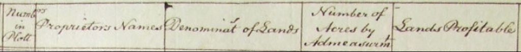
The Down Survey describes the battle this way:


On Sunday, August 8, 1647, near Knock (later Summerhill) and on Dungan Hill, there was a great battle between the the Irish Confederates and the English Parliamentarians. The Irish Confederates were led by General Thomas Preston, who were planning to march on Dublin, which was held by the Parliamentarians. The Irish Confederate army consisted of about 4,000 foot soldiers pikes and heavy muskets, and a small cavalry of about 800 horses. They had been attempting a siege of Trim, but when the Parliamentarian force left Dublin, Preston decided to strike Dublin.

The Parliamentarian force, commanded by Colonel Michael Jones, had about 5,000 foot soldiers, a 1500 horse cavalry, and artillery. He caught Preston about ten miles south of Trim at Dangan. While the Irish cavalry waited on Dangan Hill, the Irish foot soldiers forces were hidden in a field of tall wheat preparing for a surprise attack, but this strategy made it hard for them to see anything. The Irish cavalry was then caught on the road by the English.

 The English won the battle, slaying nearly over 3,000 Irishmen, and taking over 900 prisoners, including surviving leaders. Three of Garrett Lynch's sons died in the battle. According to Irish accounts, the troops were slaughtered even after attempting a surrender.  The English, too, had heavy losses of over 2000 men. Preston, himself, escaped through the bogs with about 2000 men. He requested a burial of the dead, but received no reply. It appears that Jones wanted the bodies of the dead to remain as a haunting reminder of the battle. Some reports say that the dead were not buried until 4 months later. 

The Battle at Dungan Hill was a turning point that signaled the end of the Irish Confederacy.

In 1652, Dunganstown, the town of Knock and lands belonging to Gerald/Garrett Lynds/Lych , now an outlaw rebel accused of treason, were granted to Henry Jones.


 but despite this, Garrett did not recover his lands at Knock after the 1660 royalist restoration.


Forfeited estates after the battle included over 4,175 acres of land in Laracor's townlands. The owners who forfeited their lands included Garrett Lynch (743 acres in Knock/Summerhill) Valerian Wesley (Umberstown, Clondoogan, Clonmahon, Dangan,) Richard Lincham- an Irish Catholic ( Clondoogan, Adamstown, Collinstown, Somertown), Christopher Lincham (Great Freffans) Robert Rochfort- an Irish Catholic (Dangan) Garrot Smith (Dangan) George Stoakstowne (Stoakstown) and George Vaher of Dublin (Little Freffans)


Cromwell's War- 1649-1653

Cromwell, leader of the English Parliamentarians, invaded Ireland from 1649-1653.
In 1642, the Protestant Duke of Ormonde besieged and captured the castle at Knock. It was occupied by Cromwell's forces in 1647. Knock Castle and land was forfeited during Cromwell's invasion, and given to the Protestant Bishop of Meath, Henry Jones.

In July 1649 the castle at Trim was taken by royalists under the Earl of Ormonde, who gave directions that it should be destroyed if conquered by Cromwell, however the castle survived after he took it, and was occupied until about 1690.


Sources:


Laracor Parish in early days

Trim- Its Ecclesiastical Ruins, its castle, etc. 1886

https://books.google.com/books?id=MvcRAAAAYAAJ&pg=PA38&lpg=PA38&dq=great+freffans+meath&source=bl&ots=_EN4IZR84Q&sig=jDyAIaBRNz-luY8R84_313-ujLM&hl=en&sa=X&ved=0ahUKEwi-2MzzyqjcAhVCEawKHeAHBIM4ChDoAQhCMAU#v=onepage&q=great%20freffans%20meath&f=false


The Down Survey of Laracor Parish, County Meath


The Down Survey of Ireland, conducted from 1656 to 1658, was an ambitious project to map all existing land ownership in Ireland. Its purpose was sinister; those lands that would be forfeited by Irish Catholic landowners would be given to Cromwell's supporters and English Protestant soldiers. Nevertheless, it is one of the earliest maps of its kind, and shows us a great deal about Ireland before the massive land confiscations. The Down Survey website also provides an interface between the ancient maps and modern maps.

Down Survey Maps

Here is the map for Laracor Parish, County Meath, where our Allen and Sweeney Ancestors lived.


A close up reveals Dangan, owned by Valerian Wesley, and Umberstown (home of our Allens and Sweeneys) owned by Valerian Wesley and Robert Lincham. Many of the surrounding areas also show Gerrald Linch as part owner.


I realized these maps are not aligned N-S - the map below shows Umberstowne, Dangan (Dingen), Clonmahon and Clondougan, and "Lynchknock" (later Summerhill) with the ill fated Dungan Hill and bog just outside of Lynchknock and its castle. (see separate blog on the Battle of Dungan Hill.)


The survey went on to show the proprietor of the land, the acreage, and how many of those acres were profitable.


Umbrestowne, owned by Valerian Wesley and Richard Lincham, was 273 acres, all considered profitable land. Dangan (Dingan) owned by Valerian Wesley (papist) was 589 acres, all profitable. Valerian Wesley saved his lands, by, as the conquerors had hoped, converting to the Protestant religion.


Knocke, owned by Garrett Linch was 743 acres, all profitable. But notice that after Garret's name it shows "pap." This marks the land as among those to be confiscated. While Garrett Linch was away, the castle was stormed by the Marquis Ormonde and the male inhabitants slain. It was sold by the Protestant Bishop of Meath, Henry Jones, to Sir Hercules Langford in 1661.  Sir Hercules Langford would be the builder of Summerhill Estate.


The survey describes the soil of the area as good, with arable meadows and pastures and only a little bog on the southwest end. It then goes on to describe the Battle of Dinganhill, where more than 5800 men were slain. (See separate post)

It describes in Knocke a fair house and an old castle in repair, some very good woods and a mill. It also describes a town at Clomahon and Clondoggan and some small villages at Umberstowne with a few cabins and a fair stone house in Dangen. 

The 1670 Survey showed how forfeited lands in the area had been transferred to Protestant landowners.

At Dangan, 589 plantation acres that were owned by Catholic Valerian Wesley now belonged to Protestant Garrett Wesley.

At Great Umberstown, 273 plantation acres that were owned by Valerian Wesley were now owned by Sir John Stephens.

At Clondoogan, 401 plantation acres that had belonged to Richard Linchamp (who was a Protestant) now belonged to Sir John Stephens as well.

The Summerhill Demesne which had belonged to Varerian Welseyin 1641 now belonged to Garrett Wesley, as did Moy.


Saturday, February 15, 2020

Places: A Gentleman's Description of Summer Hill and Dangan in 1828


Dangan Castle


    Summerhill


" Being desirous of seeing the ancient castle of Dangan, the birth-place of the hero of our day (the Duke of Wellington who defeated Napoleon at Waterloo in 1815) we left Dublin for Summer Hill, a village about thirty miles from Dublin, and a very short distance from Dangan Castle. It was autumn, and, as we reached Summer Hill late, we went quietly to bed- deferring the object of our curiosity till the morning."

"We arose almost with the sun on the following morning, and after a rural breakfast in one of the prettiest villages in Ireland, Summer Hill, we set forth on our walk to Dangan.


Dangan


"The day brightened as we left the village, and we saw at a mile's distance the gates and woods of Dangan. We passed down the side of the domain wall, and, pursuing a noble road with woods on each side, at length reached an eminence, whence Dangan Castle burst on our view. Its windows glistened in the morning sun, and many coloured foliage added to its beauty."

"Having walked over the domain, we proceeded to the castle, and examined the interior of it. It is now quite a ruin, having been sold by Lord Wellesley, (father of the Duke of Wellington) and since the sale has passed through many hands. It had, moreover, suffered recently by some fire, so as to look more picturesquely in a distant prospect than upon a close inspection. The shell of the castle, which had so fine an effect, with its battlements and turrets amongst the surrounding woods, had a very different aspect as we approached it. Still it appeared to us as historic ground, and we lingered long in the domain and its vicinity"

"We passed the rest of the day in walking through the adjacent country, which is fertile and well cultivated. From every part of the landscape, the woods, and frequently the castle of Dangan were to be seen. We continued to walk through this wild and romantic scenery, and could not but be pleased with the varied landscapes of a fine corn country, always terminated, and, as it were, framed by the beautiful and extensive woods of Dangan. We stopped at an humble Irish cottage; the inhabitants produced a repast of potatoes and milk, of which we of course partook. How exceedingly cheaply are the Irish peasantry maintained- how cheaply might even an English family, and of the first respectability, live most substantially in Ireland. The largest and fattest fowl is six-pence or seven-pence- a goose thirteen pence- a turkey the same; taxes almost nothing, and labour not a shilling per day. The rent of land is about twenty-five shillings the English acre, and in taking a domain of fifty or sixty acres the house is rated as nothing, being included in the rent..."

"....The wages of maid-servants are about four pounds a year- of a coachman about ten. Every family makes their own candles and soap..." "..We returned to Summer Hill to sleep....in a quiet slumber at a village inn.


"With the first gleaming of the golden sun, illuminating the peaceful village, we set out for Trim.....we again approached Dangan Castle on our way to Trim..."


..."Proceeding toward Trim, a country town thirty miles from Dublin, we passed through some of the finest and best cultivated land we had seen in Ireland. Good farm-houses, large fields, and every appearance of good crops and proper cultivation, showed us what Ireland might become under due culture. "


Trim


"Upon bidding farewell to this interesting little spot we passed on to Trim, a considerable Irish country town. The old castle is the most striking and picturesque feature of the place. It is situated upon the memorable Boyne, which is here about as wide as the Thames at Richmond; and is beautifully blue. when Marquis Wellesley sold his castle at Dangan, he resided some time here. Trim is likewise remarkable for the occasional residence of (Jonathan) Swift (Church of Ireland cleric, later dean of St. Patrick's Cathedral in Dublin, best known for his book "Gulliver's Travels" written in 1726) his parsonage at Laracor being near it. "


"...Again we beheld the cradle of our Wellington, and the baronial edifice of King John, for in his reign it (the castle at Trim) was built. The first dawn of the morning was on its walls; the autumnal woods reddened with the rising sun; the cheerful redbreast poured forth its song; and the sheep grazed through the domain. It was altogether a picture of exquisite rural beauty and country repose."


Trim


Journal Source:
Mr. Peel- page 183-page 188  
Public Characters of the Year 1828
Printed by Longman, Rees, Orme, Brown and Green
Paternoster Row, 1828
(Pictures are not from the book- found on Google images)


Monday, January 28, 2019

Children of Richard Allen and Margaret Sweeney County Meath- John Allen 1833 Summerhill- 1918 Summerhill


"When distributing the estate of Richard Allen (1843-1872) in Illinois, John, Catherine, and Edward were listed as living at Summer Hill, County Meath, Ireland. Edward later came to U.S. in 1880." from genealogy notebook of Helen and Marjorie Allen

John Allen

John Allen was baptized in the Dangan Church in Summerhill Parish on May 20, 1833. He was a year older than his brother Hugh, our ancestor.


John remained single and stayed on the family farm with his parents, Richard Allen and Margaret Sweeney Allen.

In the 1901 census John, age 62, was still farming and living in Great Umberstown, with a 19 year old cousin, Jane Moran. The census notes that John can read, but cannot write, while Jane can both read and write. This would fit with Aunt Helen's memories of her sister Mary Allen writing letters for their Uncle Tom Allen (who lived with their family until his death in 1920) to his brother back in Ireland. John would then have a female relative in Ireland write letters back.


In 1911, John, now listed as 76 (there doesn't seem to be much attention paid to ages, although the church baptismal records don't lie!) is farming in Great Umberstown, but his nephew, Thomas Byrne, 37 and single, is helping him with the farming.This notation of Thomas Byrne as his nephew was the key to unlock the mystery of Catherine Allen- the other sibling who remained in Ireland.


John died of old age on January 8, 1918 at the family farm in Umberstown. Margaret Byrne was with him at his death.


Sunday, July 22, 2018

Children of Richard Allen and Margaret Sweeney County Meath- Catharine Allen Byrnes 1847 Summerhill- 1916 Clonmahon


The name "Catherine" has stayed with Allen descendants through the generations. This post is dedicated to you!

It appears that the family of Richard Allen and Margaret Sweeney had only two daughters- the eldest child, Mary, born in 1826, and the youngest child, Catharine, born twenty years later. Eight brothers were born between the two girls! Hugh would have been about 12 years old when Catherine was born on May 21, 1847- at the height of the famine. Catharine's closest sibling would have been her brother Edward, who was just 3 years old when she was born.

Catherine Allen's baptismal record at Dangan Church in Summerhill Parish

As a child, Catharine would have watched her elder siblings emigrate to America in the 1850's. She grew up in the little cottage on the farm and then remained home with her brothers John and Edward to care for her aging parents. We don't know when her mother died, but her father, Richard Allen, died in 1866. 


Courting was difficult for a young girl after the famine; many of those young men who survived had no land to offer a family, or had emigrated abroad to seek their fortune. But when Catharine was 23 she married- albeit to a man twice her age. Her husband was Owen Byrne, a 45 year old grocer. Owen's first wife, Julia McNamee, had died in 1868, two days after giving birth to her son, Eugene. Owen was left a widower with five young children.

 In the spring of 1872, Owen and Catharine were married. (Note that even at age 24, she is listed on her marriage record as a spinster!) Their witnesses were Patrick Young and Mary Reilly.

Catharine Allen's marriage to Owen Byrne

After her marriage to Owen, Catharine lived in Clonmahon townland, just north of the village of Summerhill, and only a few miles from her Allen family in Great Umberstown. Her first son, Thomas Byrne, was born on May 4, 1873. A daughter, Margaret, followed on April 18, 1875. Catharine and Owen would have 5 children together.

The 1901 census shows Owen, age 78, Catherine, age 50, Thomas Byrne 26, and Edward Byrne 13, living in Clonmahon. They lived in a nice stone house with 5 rooms inside. Owen also had a farm, and Thomas was working the farm. Edward was still in school. This was an educated family- everyone could read and write.


The 1911 census, Catherine was 69 years old, and her husband, Owen was 90!
Their son, Edward, was a young man now, 23 years old. Patrick Byrne, age 50, and his wife and family live nearby.

 Catherine's son,Thomas Byrne, was no longer living with them. In the 1911 census he is shown living with his uncle, John Allen (now 76 years old) helping with the farming on the Allen family farm in Umberstown. 

Catherine died on January 11, 1912. She was 60 years old, and suffering from heart disease and "dropsy"- what we would call congestive heart failure. She died at her home in Clonmahon, with her son Thomas Byrne, of Umberstown, signing that he was present at her death. Owen lived to be 94 years old, dying in Clonmahon in 1916. Thomas was also present at his death.

Civil Death Registration for Catherine Allen Byrne age 60

What happened to Catherine's other four children? (next post)

Sources:

Ancestry.com. Ireland, Selections of Catholic Parish Baptisms, 1742-1881 [database on-line]. Provo, UT, USA: Ancestry.com Operations, Inc., 2011.

Ancestry.com. Ireland, Select Catholic Marriage Registers, 1775-1942 [database on-line]. Provo, UT, USA: Ancestry.com Operations, Inc., 2014.

Ancestry.com. Ireland, Select Births and Baptisms, 1620-1911 [database on-line]. Provo, UT: Ancestry.com Operations, Inc., 2011.

Original data: Census of Ireland 1901/1911. The National Archives of Ireland. http://www.census.nationalarchives.ie/search/: accessed 31 May 2013.

Catharine Allen Byrne's civil death record- you will have to sign in but it will then take you to the record. If you click on "image at the bottom, you can see the original entry and download this if you wish.

Sunday, July 8, 2018

Allen Blog- Making a Map of the Allen Farms in County Meath


Thank goodness for hedgerows and stone fences! These classic land markers have stood the test of time...


Hedgerows and an old stone wall near Richard Allen's farm in Ireland

If you take a look at Google Satellite Maps, and type in Summerhill, County Meath, Ireland, you will come to the area in Ireland where our Allen ancestors lived. If you zoom in a bit, you will see that the many fields of green are subdivided by clear lines of trees and hedgerows. In some areas, I recognize hawthorns, which grown on my land here in West Virginia. I am fairly certain that it is impossible to kill these thorny bushes, which soon grow into small trees. Cut them down, they sprout from the stump. So maybe it is no surprise that briary hawthorns, multi-floral rose, and old stone walls still divide fields in Ireland. In any case, this time they were a great help to me.


 Griffith's Valuation of 1855 lists each tiny townsland, the inhabitants, their acreage and whom they leased from. It gives a number key which corresponds to the 1855 Griffith's Map. I had found Richard Allen's farm, where Hugh Allen and his sibling grew up in Great Umberstown, (Laracor Civil Parish) not far from the town of Summerhill.


 Now I wanted to find the other Allens in the area who were likely his kin, as well as the Sweeny's, who were likely the kin of Richard Allen's wife (Hugh's mother) Margaret Sweeny. Here is a list of all of the Allens in Laracor Civil Parish in 1855.


Allens in Laracor Civil Parish


If you click on the largest "Original Page" symbol next to the name, it will go to the page which shows the person under their townland, along with information on their farms- who their landlord was, how many acres they leased, and how much tax they paid. Here is Richard and John Allen, Patrick Sweeny and their neighbors in the townland of Great Umberstown .

Great Umberstown townland- neighbors

On the left of this list is a key which shows the number of their farm on the Griffith's Map. Going Back to the Allen's in Laracor Parish list, after the "original page" symbol is a "Map Views" symbol. The one on the right will take you to the Griffith's Map. Here is what you find if you click on the map view for Richard Allen.

Griffith's Map View for Richard Allen in Great Umberstown

As you can see, you  have to zoom in and hunt a lot to find Great Umberstown, then zoom in until you find the number for Richard Allen's farm (4a.) It takes a while! And all of those tiny townslands are confusing! Where in the world is "Ballinrigg??


I wanted to get a better idea of where the Allen and Sweeny families lived in the area, so I decided to make a map of the farms from Griffiths- labeling them so I would have a better picture of where they lived and how far apart their farms were. I used Google Maps to create a map on "My Maps" and clicked on the Satellite View.

There they were- those tenacious hedgerows. They still matched up nearly exactly to the land plots in the 1855 Griffith's Valuation Map. I was able to follow the hedgerows on the Google Map to draw lines and map the properties. So- long story short, here is the map. Most of the Allen farms were within a half hour walk to the church in Dangan, and less than that to each other's farm. We have no proof at this time that they were related, but it is certainly highly likely. (Someday with more DNA evidence...)

 Here is a link so you can see the Allen farms marked on the map. You can click on each shape and it will tell you who lived there.  If you go back to You can also zoom in to explore how the farms look today. If you want to explore further, you can go back to regular Google Maps and find the farms (just follow the roads.) Street view appears to work well in this area so you can drag the little person onto the road to take a walk though our ancestor's neighborhood. Hope you enjoy!

My Google Map of Allens near Summerhill


Saturday, May 17, 2014

Allen Blog-Hugh's Story- Part 8- The Feast- Summerhill Demesne


Summerhill House

Summerhill Demesne

Listed on the same page as the Allen family on Griffith's Valuation is "Summerhill Demesne." Demesne is a feudal term, referring to times when the king granted large pieces of land, or baronies, to his barons who lived on the demesne property, which included their own home, plus gardens, hunting grounds, etc. These barons leased out the land they owned surrounding their home to serfs.) Ireland in the 1800's still operated much like a feudal society. The serfs had become tenant farmers, still dependent on the baron for their living.

The landowner of Summerhill Demesne in 1855 was the Honorable Hercules L. Rowley- Lord Langford. The valuation shows that the demesne included 755 acres of land. All in all, Lord Langford owned 2,231 acres throughout Ireland.

The 2nd Baron Langford succeeded the title in 1825, the same year as the marriage of Richard Allen and Margaret Sweeney.
This Baron lived only 14 years after succeeding the title, dying in 1839, and leaving his 15 year old son as heir. His son was educated at Eton, but also died young, at age 29 in 1854, leaving the title to his 6 year old son, who lived until 1919.

         Baron Langford
                                    
                             Sir Hercules

An excellent overview of the lives of the Langford family and other landed families in Meath is offered by Terence Dooley in "A World Turned Upside Down; a study of the changing social world of the landed nobility of County Meath- 1875-1945." These families lived a "Downton Abbey" type existence, hiring an army of servants from England, Scotland, and Protestant Ireland, with few Irish Catholics employed on the grounds. Servants who were employed generally lived on the estate in cottages or in the attics of the house. They generally worked 6 days a week, for very little pay.


                                                                                                          Summerhill House                

The family entertained guests at lavish dinners and all night balls were held on occasions. Games such as croquet were popular during the day. Gentlemen enjoyed shooting for game on the vast grounds, which also brought food to the table. Fox hunting, however, was the most important activity, often taking place five days a week. Tenant farmers were required to allow the hunt to cross their fields. Racing and steeplechase events were also popular. The Meath nobility were well known for their breeding and ownership of fine horses, used both in racing and hunting. Lord Langford's "Sir Hercules" was unbeaten in Ireland in 1828 and became a famous foundation stud in Irish racing.

One claim to fame of Summerhill Demesne is that is was visited/rented by the Empress of Austria in 1879-1880, who sought it out due to its reputation for excellent hunting and hounds. The Empress was, by the way, Roman Catholic, and even constructed a Catholic chapel in the house for worship during her stay. (Apparently the residents tolerated Catholicism in an empress!)


                                                                   Catherine, Empress of Austria

The Langfords tended to be absent landowners, and were away in London when the IRA burned Summerhill House in 1921. Once one of the greatest houses in Ireland, now only ruins remained. In time, even the memories of the greatness of Summerhill faded away. I read recently that now, even the ruins are gone, plowed over and planted into fields.


The 4th Baron Langford- National Portrait Gallery


More information on Summerhill Demesne and the town of Summerhill can be found at:

http://www.meath.ie/CountyCouncil/Heritage/ArchitecturalHeritage/ArchitecturalConservationAreas/File,40004,en.pdf


[1] www.askaboutireland.ie- managing a big house- a servant's lot

[2] http://www.abandonedireland.com/Summerhill_1.html


Friday, May 16, 2014

Allen Blog- Hugh's Story- Part 7- The Leslies- Landlords of the Allens


The Leslie Family 1905 [all photographs by Mark Leslie- see citation at end]


It is unlikely that the Allen's ever met their landlord, Charles Powell Leslie. His vast estates throughout Ireland were handled by agents who collected the rents and took care of the details regarding the lands and their tenants. The Leslie family lived on their country estate in County Monaghan in Northern Ireland.  Like most wealthy families of the time, they also likely kept a Dublin residence for the social season there (Christmas to St. Patrick's Day) and then a London residence for the summer ball season- to introduce their daughters to society. When on their Irish country estate, they would have spent leisure time shooting, fox hunting, and entertaining at dinners and balls. Their home was a showcase, filled with symbols of wealth and works of art. [1]


The lives of the Leslies were a world apart from those of their tenants. Children were educated at home by governesses and tutors and then boys were sent on to Eton or Harrow before college. A grand tour in Europe would have been considered a part of their education for most. 


The indoor staff at Castle Leslie 1890


Norman and Shane Leslie with their father 1897


Charles Powell Leslie II (1769-1831) would have spent a great deal of time in Dublin, as his father was a member of Irish Parliament representing their home estate in County Monaghan. He was educated at Oxford and became a colonel for the Monaghan Militia, which succeeded in putting down the 1798 Irish Rebellion. According to Irish Leader Daniel O'Connell, he was "one of the most uncompromising enemies of his Catholic country men." [2]Moving to London to sit in Parliament there, Leslie voted against proposals for Catholic Relief in 1811 and Catholic Emancipation and lost his seat in Parliament on that issue in 1826.

His son, Charles Powell Leslie III (1821-1871) was ten years old at the death of his father. He came of age during the famine years and was much more supportive of his tenants than his father had been. He promoted free education for local farmers to study scientific farming methods. [3] During the famine years, this generation of Leslie's was known to suspend payment of rents for struggling tenants and there is no record of them ever evicting tenants during these hard years while Ireland suffered from widespread mass evictions. Leslie also organized relief work to try and provide income for families during the famine years, and his mother set up soup kitchens to provide for the starving. [4]


Lady Leslie with local school children in Glaslough 1890


His heir, Sir John Leslie, built Castle Leslie in Monaghan in 1870 on a 1000 acre estate. His wife, Lady Leonie Jerome Leslie, was the sister of Jennie Jerome Randolph Churchill, who was the mother of Winston Churchill.


Lady Leonie Leslie (on far right) with her mother and sisters (Jennie Churchill standing with Winston on her left)


The eldest son and heir, Norman Leslie, was tragically killed in WWI. His brother, Shane Leslie, inherited the estate. Interestingly, he converted to Catholicism (and as a result was disbarred; but remained the heir.) He also married an American, Marjorie Ida, a native of Vermont (who was actually raised in American Samoa, where her father was a diplomat!)


Marjorie wife of Shane Leslie at Castle Leslie


Lady Leonie Leslie with Princesses Elizabeth and Margaret


Castle Leslie in County Monaghan is still in the possession of the Leslie family, and is open to paying guests. The chapel there gained notoriety recently when it served as the wedding place of Paul McCartney.[5] An extensive history and virtual tour is available on the Castle Leslie website:


*All photographs on this page were submitted by Mark Leslie to "Edwardian Country House Life" on "Travelers 411."  More of his photo collection on the Leslie's can be seen on that site.

https://www.travelers411.com/forums/album.php?albumid=721


Thursday, May 15, 2014

Allen Blog- Hugh's Story- Part 6- Nearby Towns and Market Days

Market Day [1]


                          Market Day


Market days were held in the nearby town of Summerhill to the southeast and in the historic medieval town of Trim to the north. The pretty village of Summerhill was a little over three miles from Great Umberstown. [2] This would be about an hour’s walk- although if they owned a horse and cart, with any luck the cart was piled high with produce for sale on market day! Although this distance may seem a long way walk for us, the folk of the time routinely walked much farther than we do today, and walking was considered an enjoyable pastime- with a day at the town market a much anticipated outing. This was a chance not just to buy and sell goods, but to visit with other friends and neighbors, catch up on news and gossip, and for young people, a chance to court potential sweethearts. Fairs were held in April, June, September, and November.


[3]


                                       Summerhill


The village of Summerhill had first been known as “Lynches Knock” and the ruins of the original castle, could still be seen there. This was the site of the Battle of Dungan’s Hill in the 1600’s, where the Irish army was defeated in their march toward Dublin. Afterwards, Cromwell gave this land to the Protestant Bishop of Meath, who sold it to Sir Hercules Rowley, Baron Langford, who abandoned the castle to build a new family home in the 1730’s, the Summerhill Demesne, which stood outside the village. In 1837 the village had 331 inhabitants and 49 buildings. In 1901 these included a post office, police barracks, doctor’s office, three groceries, bakery (which delivered bread to villagers by horse and cart,) a sweet shop, two pubs, and a tannery.[4]


                                                                                             [5]
Summerhill Post Office circa 1911- postmistress Phyllis Gogarty of Clondoogan (The Gogarty's were friends of the Allens) [6]


A Fair Day in nearby Navan, Meath [7]

Trim


The historic medieval city of Trim, on the river Boyne was about four and a half miles to the north and could be reached by walking in about an hour and a half. [8] 


Trim, which was once the county seat, had weekly markets. In 1837, there were about 570 houses, and 3,000 people residing in the town. There was a flour mill, a brewery, and a tannery, and outside of town a large mill which produced quantities of flour and oatmeal. There were army barracks in the town with about 80 soldiers stationed there. A new courthouse had been built, as well as a county jail which could hold 140 prisoners.[9] 

Trim Castle was home to Ireland’s largest Norman Castle, build in the 12th century. (This castle was used recently in the filming of "Braveheart.") Trim was also once home to historic Catholic monasteries and abbeys, destroyed during the reformation, but whose ruins still existed about the area. Trim was where the dreaded workhouse which was built to house paupers, and a dismal place of last resort for many who faced hopelessness and starvation during the famine years.

Boyne River and bridge into Trim


 Trim circa 1900


Returning from Market [10]

Resources and information on Summerhill history and Summerhill today:

The report below has many pictures of Summerhill- both today and historical- as well as maps of the area:

http://www.meath.ie/CountyCouncil/Heritage/ArchitecturalHeritage/ArchitecturalConservationAreas/File,40004,en.pdf

Shaw's Pub is the local tavern with food and live music:

http://shawspub.wix.com/summerhill


[1] Illustrated London News 1857
[2] Google Maps- directions-See photo tour google maps link https://mapsengine.google.com/map/edit?mid=z2xplTJpQDmE.k36UII-Kc9ik
[3] “A Topographical Dictionary of Ireland 1837 by Samuel Lewis http://www.libraryireland.com/topog/
[7]http://www.navanhistory.ie/index.php?page=fair-green
[8] Google maps- directions- see photo tour google maps link
[9] “A Topographical Dictionary of Ireland 1837 by Samuel Lewis http://www.libraryireland.com/topog/
[10] Illustrated London News 1857